NaNoWriMo Furlough

/ Thursday, November 10, 2011 /

If you haven't noticed, the posts have been slow coming the last few weeks. On the internet, it is National Novel Writing Month and I am attempting to write a second novel in 30 days. It's brutal and has consumed much of my free time this month already.

From now until the end of November, I beg your pardon. I will try to update once a week though and keep the Twitter stream flowing more often than that.

Thank you.

Possible places Peregrine Falcons can nest

/ /
In a previous post, I announced that Manchester Oblique would be helping crowd source a map for possible Peregrine Falcon nesting locations. Readers could submit pictures and addresses of buildings, more than eight stories high or 80 feet tall, and the 5th grade class at Webster Elementary will use these photos and locations to build a map as part of an Urban Wildlife program that is being headed by Helen Dalbeck of Amoskeag Fishways.

Here are the photos, but we need more! If you see a building meeting the requirements above, please send a pic and an address and I'll add it here.

More photos after the jump.

1750 Elm St. by Helen Dalbeck

Manchester Oblique on NHPR

/ Saturday, October 29, 2011 /

On Thursday, NHPR's Brady Carlson talked with me about Manchester Oblique. You can listen to the segment online here.

Help Webster Elementary map potential Peregrine Falcon nests

/ Tuesday, October 25, 2011 /

It's not uncommon for smaller critters to make their homes within our houses, office buildings and other artificial structures —often to the distaste of the owners— but in Manchester there is one place where a larger set of animals are welcomed. A top the Brady Sullivan building at 1750 Elm St. resided a family of nesting Peregrine Falcons until June this year. The falcons have nested on the 13th floor of the building five years in a row and biologists have tagged each chic to study the length of their lifecycle.

Female at 1750 Feb 2011 via Spectra Access
Helen Dalbeck of Amoskeag Fishways is piloting an urban wildlife series with the 5th grade class of Webster Elementary School in Manchester. The series is focusing on the Peregrine Falcon and where else they might nest in the city. She has extended a challenge to the Manchester Oblique readership to help out and send in pictures of any buildings in the city that are either 8+ stories tall or 80+ feet tall (church steeples and alike included), along with their addresses (coordinates are also welcome), so the class may build a comprehensive map of other potential Peregrine Falcons nesting sites. 

If you have quick few minutes and would like to help out, snap a quick photo of a tall building and send the photo and address to manchesteroblique at gmail dot com. I will post all of the photos here with the proper credits.

It's an interesting, natural, reuse of space that no one had intended. It would be amazing to see the tops of entire buildings dedicated to becoming bird sanctuaries, giving rare and endangered species another place to nest. You could even build enclosed observations areas where people and employees could come to eat lunch and watch these beautiful animals. Clients on a tour of the facility would stop and watch the birds-of-prey nesting before them, adding an extra wistful and warm element to their trip.


Manchester's stillborn college campus

/ Thursday, October 20, 2011 /


In the northwest corner of Manchester lies a large plot of undeveloped land, the last barren parcel in the city that isn't a swamp or park. The Hackethill area is a mix of woodlands and protected wetlands that is a beautiful piece of space, and meandering through it are long abandoned roads, parking lots and sewer systems of a stillborn project that has spanned almost 40 years now.

In the 1960s, the University of New Hampshire opened a new branch of the University called Merrimack Valley College off of Hackethill Road. A large building, called French Hall, was constructed with all the necessary classrooms and administration offices. The college had minor success and a few years later the 830 acres of land behind French Hall were purchased with the idea of building a true campus in Manchester.


A map of the future development.
The development as it currently looks via Google Maps.
The development was slow moving, as things with universities tend to be, and eventually in the early 80s, a road was paved leading into the property. Parking lots were built, sewer lines laid and electricity was even run through out the entire development, powering only the street lamps that pepper the narrow roads and parking areas. In 1986, UNH Manchester opened a branch in the millyard and there were classes both on the "hill" and the "mill," respectively. In 1998, the university opted to consolidate their two Manchester campuses and sold back the land and French Hall to the city. French Hall has since been sold to the tech company, JPSA Laser. Since the late 90s, the campus that never was has sat deteriorating against the encroaching forest and elements.

The largest of the abandoned parking lots.

One of the many broken street lamps that fleck the parking lots and roads.
Weeds, grass and full grown trees sprout from every crevice in the pavement. Mold and moss cover sidewalks that never saw the hurried footfalls of students running to their next class. Fire hydrants sit rusting and storm drains choking with leaves. The sights are a little eerie, almost post-apocalyptic, but the land itself is beautiful. It's a reminder that in only a few short decades the Earth can easily take back what we have built. I couldn't imagine what the place might look like 100 years from now if no one decided to develop it. The city could make it a free form park and archeologists could study the deterioration of modern infrastructures and see how our civilization might survive a millennium.

A barely visible piece of sidewalk.

Sadly, the land was too valuable for such an endeavor and the city sold it to Danais Realty earlier this year for $2.8 million, which plans to develop it as the Northwest Business Park at Hackett Hill. It should be noted that there is a small group of people protesting the development, as several areas of the land are protected nature preserves. You can read more about their effort here.

More photos after the jump.

Central High School pt. 3 (The James and Burns buildings)

/ Sunday, October 2, 2011 /
The James building.

You can find the first post about Central High School's Classical building here and the second post about the Practical Arts building here.

By the late 50s, Central high school was bulging at the seams with students again, riding the wave of the post-war baby boom. In 1960, the city made a shocking decision to build an entirely new school and Memorial High School was born on Manchester's south side among the numerous post-war style, single family homes behind South Willow St. In a big-picture way, it's important to recognize that this was when Manchester's commerce began seeping from downtown to South Willow St. changing the a major dynamic of life in the city.

There was a question of which Central students would remain and which would move to the new high school. The school board drew a line from Auburn that followed the east-bound rail line down to Valley St. and divided the east half of the city. The line has since represented the unofficial boundary between the inner city and the southern side of Manchester.

A student zoning map for Central, West and Memorial high schools.

Despite Memorial's construction, Central was still suffering from overcrowding and maintenance issues. A negative report from the New England Association of Schools and Colleges in 1963 cited a laundry list of complaints about the school, mainly that the buildings were "ancient" with antiquated facilities and the school relied almost completely on a homegrown faculty and staff. The report was a catalyst for much debate and the city argued whether or not to build an entirely new school. A piece of land was prospected in the Wellington Road area for a large high school but in the end the city decided to make piecemeal with the addition of the James building.

The intersection at Concord and Ash street was closed off and the James building, along with grass courtyard, were built over the roads. Despite the new building and yard, students and faculty would often arrive in the morning to find tire tracks stretching the length of the where Concord street had been.

A satellite view of Central High School via Google Maps. The red path highlight where Concord and Ash streets used to intersect prior to the James building's construction. 

The James building presents a skeletal and utilitarian look, a style called "International" that was popular between the 40s and 80s. It was connected to the Classical building by a series of walkways and housed a completely new oil-fired steam heating system. Several other renovations took place, including the roofing over of the ruined observatory and many of the school's facilities were shuffled around. It wasn't until the 80s that Central would replace the grass courtyard with concrete, a decision I'm usually sad to see, but in this case praise, as it links the school together nicely.

Almost 40 years later, stemming a rising enrollment again, the Burns building (named after William Burns, a principal of Central for 25 years and the author of the text I've pulling most of this research from) was built along the East end of the school, connecting at the Classical and James building junction. The project cost $30 million and was coupled with the construction of an underground parking garage. The facade of the Burns building embodies a mish-mash futurist and international style architecture.

The Burns building built in 2003.

Looking from one building to the other, you can trace a lengthy segment of Manchester's history and the zeitgeists of the times. The Classical building was built in a time of economic prosperity and the city needed a school it could be proud of, the result was a truly unique looking building of several combined styles. The Practical Arts building straddled the modern era with its bland brick and flat design, while still clinging to post-revolutionary America's ancient Greek love affair with its neo-classical columns. The James building is a true product of more latter-day city government attitudes of get'er done cheap and quick. And the Burns building with its alien, shiny stainless-steel facade yells that the city is looking to the future again with a certain sense of pride, ready align itself with the children's and community's best interests.

It would be wonderful to see a drafting teacher at Central teach a rigorous course in architecture, giving students pattern books to draw from and simple buildings to copy into 45 degree angle sketches. On the Monday dawning the last fortnight of school, the students would arrive at their drafting classroom to find all of their slanted, drawing desks missing. The teacher would walk them out of the school, on a warm spring day, into the sunny court yard. There the desks would sit. "Pick a building. You have two weeks to measure it and draw it. This is your final and it counts for 20% of your grade," the instructor would say.

Sadly, the Manchester school system no longer teaches drafting.

Special thanks to Mike Hennessy, a history teacher at Central High School, who lent me the William Burns text, "Sesquicentennial History: Manchester High School - Central 1846-1996" and the Manchester Historical Association's help in answering my questions.

Central High School pt. 2 (The Practical Arts building)

/ Monday, September 26, 2011 /

Note: The post originally featured a picture of Ste. Marie's School captioned as Manchester West High. This has been corrected.

You can find the first post about Central High School here.

In 1922, the opening of the Practical Arts building coincided with the opening of Manchester High School West (or West High) on the other side of the river, giving the mainly French Canadian population, or "Westies," a school closer to home, without having kids schlep across a bridge every day. With this development, the schools earned their current names. Both West and the Practical Arts building were built in the same Federalist styles and bear striking similarities to one another. You have to wonder if the city used the same firm or contractor for the buildings. Perhaps, half off the second building?

Manchester West High School (Left via Meridian Construction) and Central High School's Practical Arts
building (Right).
The PA building stood across from the Classical building on Concord street and was connected by a 300 ft tunnel underneath the street to keep students from walking through traffic or inclement weather on a daily basis. The tunnel also carried steam heating pipes to the new building. It should also be noted that, no, Freshmen do not have to pay to use it. The building contained many modern improvements but proved to be "increasingly less satisfactory as the years passed." In Burns' text, "Sesquicentennial History: Manchester High School - Central 1846-1996," he does not go into detail about the structural problems the PA building had but mentions the problems were compounded when maintenance responsibilities were handed over exclusively to the school district, like when an apartment building's handy-man is moved off site.

Even though the school had its first gymnasium, electricity and science/shop-geared classrooms, the centerpiece of the PA was the auditorium. Accessible from all three levels, it could seat 1500 people and before the Hopkins Center at Dartmouth was built, sported the best acoustic quality in the state. The auditorium also contained a mid-stage trapdoor, dressing rooms, electric lighting, recessed orchestra pit and projection booth equipped with a Simplex projector to display "flickers" or silent movies. I'm working on getting a photo of the auditorium as it is often lauded as beautiful.

With the opening of the PA building, the school bolstered a much more complex and comprehensive curriculum and co-curriculum. Vocational training classes were being supported and added every year to educate children that were not on a set collegiate path. Local, political and tax-weary critics accused the school of trying to be all things to everyone. When I read this I couldn't help but think of this quote from the same interview with Lebbeus Woods, futurist architect, that I referenced in the first post about the school:
As I wrote some years back, architecture is a political act, by nature. It has to do with the relationships between people and how they decide to change their conditions of living. And architecture is a prime instrument of making that change – because it has to do with building the environment they live in, and the relationships that exist in that environment.
Manchester, along with the rest of the country, was moving into the modern era and the school system paralleled itself with that, knowing every child wasn't college bound but needed education. The PA building and the Corey Needle buildings (a retired needle factory that the city leased and equipped with six shops) were major factors in allowing kids to study vocational skills. In 1924, Dr. Louis P. Benezet, arrived as the school system's most progressive and "erudite" superintendant. Benezet denounced much of the classical curriculum that colleges still held high and felt —with an egalitarian attitude— that it was the schools' mission to attract all manner of students and hold their interests in education. Benezet is often cited as instrumental in the Manchester schools providing a wider variety of subjects and activities. In a round-about way, he protected and rationalized the PA and Corey buildings' purpose to the public, besides the far more obvious reason of stemming a rising tide in student enrollment.

The Corey Building —cited as a "fire trap" by the fire department— would later be decommissioned in 1959 in lieu of a new Industrial Arts building behind the PA building.

Corey’s Needle Works Concord Street between Nashua and Maple Streets, looking slightly north west. It later became Parochial Arts High School Manual Training Building. (1899)
When the Great Depression hit in the 30s, Central seemed to serve as more than just a school, but the best part of many students' day, a shelter away from the turbulent world at home. For some, it was their only chance to receive food and heat. In "Sesquicentennial History: Manchester High School - Central 1846-1996"  William Burns notes that student morale seemed to be at an all-time high between the 30s and 50s and remember Central with a level of fondness that has not been seen since.

By the sixties, the school would begin to bloat with classrooms stacked deep with students and two new buildings would be birthed in contention. The final post later this week.

Group portrait of Central High School Graduation Class, 1934.

Rail road trestle to River Walk

/ Thursday, September 22, 2011 /
While I'm finishing the next Central High School post, enjoy this top and bottom view of the Manchester River walk that was once a rail road trestle spanning the Merrimack river. I was very pleased to see this thing put to good use and help further bridge that natural gap between the East and West sides of Manchester.


Hooksett's sewer disk spill

/ Monday, September 19, 2011 /

While not directly about Manchester, the city was effected by a mishap with our neighbor to the north, Hooksett. Last March, the Hooksett sewer plant "spilled" 4.3 million white, plastic, bacteria-collecting sewer disks into the Merrimack river. The disks floated down stream landing on the river banks of every adjacent town until the spill eventually hit the ocean. Disks were found washing up on beaches from Scarborough, ME to Rhode Island. The clean up is still going on as I type.

A sewer disk.

The clean up tab is approaching $1.5 million and several towns from Massachusetts, Maine and Rhode Island are billing Hooksett for their efforts, including $25,000 of contested overtime rates sent by the Bay state.

Something like this really goes to show just how interconnected everything is, especially when talking about water ways. It's a constant moving and changing space that so many are effected by. I wouldn't be surprised if a European or two happened upon one of these white disks while walking along a Spanish beach one day, picking it up and pondering it curiously, never knowing its origin or the contention it caused between several New England states before tossing it back on the ground or, hopefully, into a waste basket.

Merrimack River watershed map via Wikipedia.

A confluence of education, history and architecture

/ Thursday, September 15, 2011 /


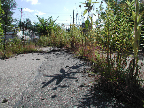
Central High School is a weird, cultural hub of Manchester, a sort of century long confluence of education, politics, history and architecture all pooling together in the center of the city. The school, once a handful of students crammed onto the second floor of an old primary school building in the 19th century, now houses 2,400 students from 60 different countries, speaking 30 different languages, in the inner city. When approaching from the Beech street side of the school, you can sense the immediate cross-section of time via the four different types of architecture the school sports.

Central High School's Classical building.


The politically contentious Practical Arts building.


In an entertaining interview with the futurist architect, Lebbeus Woods, a great quote came from the interviewer, Geoff Manaugh of BLDG BLOG that I feel encapsulates everything about why we build schools, whether we know it or not:
"There’s also the incredibly interesting possibility that a building project, once complete, will actually change the society that built it. It’s the idea that a building – a work of architecture – could directly catalyze a transformation, so that the society that finishes building something is not the same society that set out to build it in the first place. The building changes them."
Manchester made serious efforts throughout the latter half of the 19th century to build as many schools as possible and strongly encouraged enrollment and attendance. It is also worth noting that Manchester was increasingly concerned about children skipping school in the 1800s. Where as today, many worry about their spawn getting into mischief on the streets of the city, the parents and teachers of Victorian- era Manchester were more concerned with their kids being lured into the exploitative and dangerous work of the Amoskeag Mills for a few shiny cents. The city made several pushes to open more schools and to educate kids as long as possible before many would succumb to their family's financial burdens and go to work.

View of the Old High School, Beech Street, between Lowell and Concord Streets. A three story building with mansard roof, Romanesque style arched windows with elaborate window crowns, and two side pediment porticos.

When Central was just called "Manchester High School," the iconic yellow brick building standing on the corner of Beech and Bridge was not the first iteration of Manchester's high school but is its third. The first high school building stands on Lowell St in Manchester and is currently owned by the Manchester Institute of Art (the subject of a future post) and the second iteration of the school (illustrated above) was built on the same lot as Central's current "classical building."

View of the New High School Building, Beech Street, between Lowell and Concord Streets. Also known as Manchester Central High School; and Manchester High School Classical Building. A four story building with hipped roof, dormers, an unnamed street is seen on the left. Built on the site of the Old High School.

The classical building began construction in 1895 and opened in the fall of 1897, its architecture an attractive hybrid of Second Empire and Federal styles (please correct me if I'm wrong). It showcased the latest thinking in design with three floors, a large basement with coal heating, a massive attic and copper slated roof complete with drainage pipes. The school still didn't have indoor sanitation but had running cold water. The best part of the design was something removed from the building later (quoting at length from "Sesquicentennial History: Manchester High School - Central 1846-1996" by Principal William Burns):
"At the pinnacle of the roof was an astronomical dome which had a vertical opening for the viewing of the heavens with the school's telescope. The cover could be rotated manually to follow a celestial object's path. An exterior walk surrounded the dome from which there was a fine view of the surrounding city and countryside. A square-shaped classroom was built directly beneath the dome."
I remember several years back when Bedford, NH was in a political grid lock of whether or not to build a high school, some of the parents of the town had requested an observatory or planetarium to be built within the new school. Many guffawed at such a seemingly lavish request, including myself. School- owned observatories were something for private schools with their gates, uniforms and gracious alumnae donations, but here in the late 19th century, a public school had an observatory.

Another intriguing, and maybe depressing, aspect of the Manchester High School design in contrast with latter day school construction, was the thinking that school houses needed plenty of light, large windows and good air circulation- a far cry from the stunted safety windows that inhabit more modern day school.

"There had been much concern shown about student health for many, many years. Having students cooped up in small rooms with bad lighting, uneven heat and poor ventilation coupled with little or no physical movement for hour on end created many a heated argument and fostered any number of learned dissertations about student health."

Small pox, tuberculosis and cholera had swept through the country the century before and air circulation was a reason for a lot of concern in fighting contagions. The school was built with a "maze of air ducts" and a mechanical ventilation system in the basement that replaced the entire school's air within minutes. Trucks loaded with coal would arrive weekly to feed the steam boilers in the winter, which were the cause of many burns over the years.

Group portrait of fourteen unidentified Manchester High School Teachers, ten women and four men. (1905)
With Manchester living through an economical golden era straddling the 19th and 20th century, Manchester High School's student population would continue to bloat, on a mission to make every graduate college eligible. Often times, Manchester grads would hop on trains from their respective college to visit their old high school haunt and recruit students. It wouldn't be until 1922 when Manchester High School West opened its doors across the river, that Manchester High would earn its new moniker, "Central." Alongside West's opening, Central opened a new building that would become hotly contested that same fall.

More to come.

Dueling dragons

/ Monday, September 12, 2011 /
While I'm getting a (possibly) two part post together about Central Highschool and the convergence of architecture it showcases, enjoy these wonderfully symmetrical staircases lying against their bricked lairs.

Taken from the Seneca Lane, between Lowell and Concord Street.

Micro rain forests on Elm St and harnessing EMF

/ Thursday, September 8, 2011 /

"Flower on Elm" by N&D Images Flickr page.

Note: I had meant to inject these thoughts into the rail-trails post but they eluded me during the time of writing it.

With the rail lines being paved over in lieu of bike trails, I couldn't help but wonder what other transport infrastructures in the future would fall to the wayside, ripe for reuse. What if teleportation became possible or if the flying car finally made its debut? It depends on the paradigm shift in transportation, but if the automobile became outdated, there could be a plethora of abandoned space to be transformed. Think of the parking lots alone that consume 30 to 40 percent of a typical, American downtown or the 60 to 70 percent that surround malls and stadiums.

Grocery stores could fence off their antiquated parking structures, crush and remove the asphalt and plant gardens or build greenhouses, delivering fresh produce from the ground to the shelf in minutes. I-93 and I-95 could be rebuilt as tracks for high speed meg-lev trains, zipping from city to city in minutes instead of hours. Cities, no longer worried about a snow removal budgets or building and maintaining parking areas, could refashion parking garages into legit skateboard and BMX parks. Architects from all over New England could try their hand at designing next season's botanical garden that encompasses Elm St. between Bridge and Granite, creating a Brazilian inspired, micro rain forest in the summer or a desolate tundra in the winter. Dog sleds full of laughing children would pass by city hall every 30 minutes.

Smart urban design theory has relied on creating reflexive and proactive systems within cities, infrastructures that can be tensed and expanded upon, many with built in stopgaps to yield foreseeable development. In a post-automotive world, the American city has another chance to rebuild a set of veins and arteries (I don't see sporting a good walk to a local store or keeping a tightly knit neighborhood going out of fashion) but what about the endless sprawl reaching into the woods and deserts? The small towns and planned communities that were propped up on four wheels that never foresaw an end to the auto-transit age? Without significant revenue, their antiquated circulation systems may choke and die, never to be rebuilt or re-imagined. Town hall meetings might take place where seething groups of citizens demand that the roads to be repaved or planted over because they are "eyesores," while a tight-fisted opposition yells, "Why bother? No one uses them anyway?"

High voltage lines in Keene, NH from e5capeveloc1ty's Flickr page.

Another type of space that already seems under utilized are the endless, sandy and scrub brush ridden tracts that support our electrical infrastructure. Massive power lines, not unlike the proposed Northern Pass transmission line, conduct millions of high-voltage watts from power plants, across hundreds of miles of cable to power stations across the country. Outside of their intended purpose, the tracts serve as little more than fodder for four wheelers and snow mobiles, but is there a reason these swaths of wonderfully straight land can't be coupled with bike trails or high speed trains? Back in 2004, an artist, Richard Box, dug 1,300 florescent light bulbs into the ground below a set of high voltage lines as part of an installation. The bulbs lit up, sapping the wasted electromagnetic field (EMF) the lines produce. Being able to harness the excess EMF for something other than art installations and leukemia (supposedly after years of exposure) also seems like another obvious question.

"Light Field" by Richard Box.

The proposed Northern Pass transmission line, a 140 mile stretch of high voltage lines relaying electricity from power plants in Quebec into lower New England's power grid, could be a perfect chance to integrate new utilizations of the land to coincide with the development of the lines. Ideas?

The William Ela House

/ Tuesday, September 6, 2011 /

Not only does the William Ela octagonal house in central Manchester boast one of the city's more interesting pieces of architecture, it also harbors a small mystery as to when it was built. While the city's Assessor Database puts the building's construction at 1920, the Manchester Historic Association has pictures of the house dating back to the 1890s. I'm hoping a trip down to the MHA research center this Saturday will clear this up.

The Ela house in 2011.
A picture of the Ela house in 1955 from the Manchester Historic Association. Notice the house lacks its brick masonry unlike the current photos.
View of the Ela Octagon House, 585 Beech Street. In front of the House is Sarah Emma Ela and William C. Ela from the Manchester Historic Association.
Group portrait in the back yard of 585 Beach Street, Octagonal House. Two women Mrs. James G. Ela, the children’s mother and Miss Emma Jane Ela, the children’s aunt and teacher at Manchester High School are sitting together on the right under the trees. The children are William C. Ela standing with a drum on the left and Sarah Emma Ela in the center. From the Manchester Historic Association.

Happy Labor Day

/ Monday, September 5, 2011 /
Happy Labor Day from the vacant space below the Queen City Bridge. The flag was there when I found it.

South Mancherster rail-trail

/ Friday, September 2, 2011 /
The South Manchester Rail Trail
The New Hampshire rail-trails have been one of the most interesting reuses of space for me in recent years; the idea that the antiquated tracks of one form of transportation is being paved over for a seemingly timeless class of travel is intriguing. There's something romantic about traveling the same network of lines that millions had a 150 years ago on the crest of steam-powered locomotion. Images of coal covered engineers and young women in Victorian era dresses and fancy hats, swim up before your eyes as you sweat to the new Adele record on a road bike.

The rail-to-trail initiative has been around for over 25 years with over 1,600 stretches of rail road track converted into bike and pedestrian trails across the country. Manchester's recent contribution was the South Manchester Rail Trail, an attempt to connect the Millyard with the town of Londonderry using the old Boston and Maine rail line that was chartered in 1847 and officially abandoned in 2000. The idea that a company can abandon a piece of property that potentially spans entire states is baffling. What kind of paper work do you have to fill out for that? Do certain cities and counties charge fines for the pieces of track left in their lap?

Union Station at the corner of Granite St. and Rail Road Square, the last stop on B&M's Manchester to Lawrence line via Manchester Historic Association.
Time table for the Manchester & Lawrence division via Remnants of the Boston and Maine Railroad

The South Manchester rail trail is currently in development hell, with only the stretch between Beech St and Gold St paved (less than a mile). Unfortunately, a large portion of the line runs straight through the (MHT) Manchester Airport expansion and rail-trail groups are having trouble securing routes around the airport and into Londonderry. Bike trails have been notoriously underfunded in the past and are typically coupled with a start-stop construction schedule. After 20 years, the East Coast Greenway, a proposed bike path spanning the Eastern seaboard from Maine to Key West, is still less than 25% finished.

Despite what Google Maps says, the section of the South Manchester Rail-Trail connecting to the Millyard has not been built.
Despite the financial stumbling blocks and jerky production schedules, these are projects that should be lauded. Considering the country's rich history with railroads, it could be possible to connect enough rail-trails to create an expansive network of bike trails, allowing anyone with a bike and a map to travel anywhere in the nation for virtually free, with less fear of getting hit by cars. Who knows, maybe in the post-apocalypse, wise travelers will know to avoid the long stretches highways clogged with abandoned motor vehicles and opt for the old rail-trails. Fathers and sons hike across a quiet and desolate America, protecting the precious and rare trail maps that guide them. As a right of passage, the father asks the young boy to copy a piece of the map, with meticulous detail, each night next to a camp fire on the back of an old concert poster. One day it will be his own guide through the ancient, twisted necropolises of the American age.

If you want to help the rail-trail initiative in NH, visit nhrailtrails.org

The fenced off railroad trestle that leads into the Manchester-Boston airport.

Cryptoforests in Manchester

/ Monday, August 29, 2011 /

Cryptoforestry. Say it aloud once, you won't be disappointed. It sounds like spies should be implanting sensitive information into the DNA of trees to be later decoded by their colleagues, or that some pine farmer is planting his trees in specific patterns only to be deciphered by the satellites above. 

Admittedly, the beautiful neologism sounds more attractive than the actual meaning. In the shadows and forgotten corners of urban development, a weedy revolution is taking place. Trees, grass and wild flowers sprout from the cracks of old pavement and forlorn planters. Young saplings push through the checkered, linoleum tiles of some condemned gas station without the aid of human hands, slowly pulling the property back into the forest. These feral patches of trees and plants are cryptoforests, once developed and maintained areas, now languishing, overlooked and hidden in private ownership, are slowly reverting back to the vegetative constant of the environment. When it has the chance, nature finds a way.


Considering Manchester's lengthy history it's surprising that the city doesn't have more cryptoforests, a testament to the city's developmental abilities and entrepreneurism (Detroit might be another story), but I've spied a few. Beyond the South Manchester Rail Trails, is a rich and large cryptoforest sprouting with unnatural looking dogwoods, weeds and pines between and behind old industrial buildings, half of which look abandoned. Underneath an overpass on Elm street, plants and small trees, with a more water based nature, overgrow an abandoned railroad line, fenced off from the human interaction. The Union Leader recently published a short article about the old gas station and the maturing cryptoforest on the corner of Lake Ave. and Hanover St., ruling it an eyesore.


It's easy to condemn these botanical reclamations of space, but after briefly wandering through the lot on Hanover and Lake, I was surprised by the unexpected and eerie beauty of the whole thing. I felt like I was exploring the ruins of a distant, post-human future while the endless rumble of motors beyond the weathered chain-link fence mired me in the present. I was also surprised by how large the space felt once inside its confined forest, with all it's new nooks and crannies to explore.


The ecology of the cryptoforests are also kind of curious. What are considered weeds or invasive plants, tend to be the first to pop up, like hard to kill marines, overtaking the area and exploiting every crevice in the pavement and other structures before the calvary of larger trees and bushes arrive. It's funny to think of weeds as mother nature's botanic foot-soldiers.

Have you seen a cryptoforest in Manchester? Send pics to daniel dot brian at gmail dot com and I'll post a few here in the near future.

Further reading: Cryptoforestry blog
 
Copyright © 2010 Manchester Oblique, All rights reserved